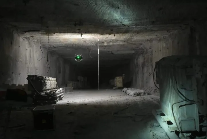
A GPS-denied drone operates using advanced onboard visual sensors, enabling it to navigate in spaces devoid of GPS signals. This capability makes it particularly useful in environments where traditional GPS systems fail or are unavailable. Most contemporary drones depend heavily on the Global Positioning System (GPS) for navigation and hovering. Although GPS drones are dependable and precise, they face limitations in certain scenarios, especially indoors. As the adoption of drones expands across various industries, the demand for drones that can function without GPS continues to rise. Almost every sector utilizing drones for inspections can benefit from GPS-denied drones, as they enable data collection within confined spaces. Industries such as mining, oil and gas, power generation, wastewater management, and pharmaceuticals stand to gain significantly from employing drones that do not rely on GPS. Some of the key industries that can leverage drones without GPS include mining, oil and gas exploration, power generation facilities, sewer/wastewater infrastructure, and pharmaceutical production lines. In this guide on GPS-denied drones, we will delve deeper into several aspects: A GPS-denied drone is engineered to depend on onboard sensors for navigation rather than relying on GPS. Most standard consumer drones utilize GPS to maintain stability and orientation while in flight. However, in GPS-denied environments, either the connection to GPS is absent or the signals are too weak, leading to erratic or unstable flight patterns. Additionally, in certain contexts, such as operations involving sensitive or critical infrastructure, GPS might be undesirable due to perceived security concerns, as it is often associated with requiring an internet connection. Despite these perceptions, GPS does not necessitate an external connection and poses no real security risk. Nevertheless, many professionals working at locations like nuclear power plants prefer drones that do not require GPS at all. According to NASA in the U.S., a future requirement for all drone technology may involve the ability to navigate without GPS: “One of the FAA’s requirements will likely be the ability to navigate in the event of a GPS outage...because GPS signals can often degrade at low altitudes in urban areas—precisely where the highest precision is needed.†- NASA GPS-denied drones rely on a sophisticated array of onboard sensors for navigation. Onboard optical sensors serve as the drone's eyes, stabilizing it throughout its flight. Each sensor provides the drone with crucial data regarding its altitude, attitude, and location. Armed with this information, the drone can operate effectively as if it had a GPS signal. Onboard LiDAR sensors may also be employed to provide the drone with its real-time location in space using SLAM (simultaneous localization and mapping). This allows the drone to remain stable and create 3D maps of its surroundings in real time while flying. A SLAM drone like Flyability’s new Elios 3 (shown below) combines visual sensors and LiDAR sensors to generate 2D or 3D maps throughout its flight. Three-dimensional models offer comprehensive coverage, which is invaluable for inspectors navigating confined spaces. LiDAR, or Light Detection and Ranging, is a relatively novel technology. It functions by emitting pulses of laser light toward objects to construct 3D images. Upon the light reflecting back, sensors determine the structural composition by calculating the time taken for the light to return or by analyzing its wavelength. Consider this technology akin to a fish finder. A transducer emits sound waves into the water. When these waves encounter fish and the lake structure, they generate an image displaying the approximate depths of the fish and the lake bed. An intriguing aspect of LIDAR sensing technology is its capacity to penetrate foliage and debris. This ability makes SLAM drones excellent candidates for search and rescue missions and numerous other applications. Flying drones without GPS is not a new concept. In fact, many early consumer drone models lacked GPS modules, which made them challenging to operate and prone to crashes due to both the absence of GPS and the overall immaturity of the technology. Moreover, many autonomous drones can switch to non-GPS modes. A common challenge associated with GPS-denied drones is that most pilots are untrained in handling the drone without GPS assistance. However, with a GPS-denied drone, the sensing capabilities and advanced sensors excel in challenging conditions where the GPS signal fails. Here are eight scenarios that call for the use of a GPS-denied drone: Many of the applications discussed so far are technically indoors, but GPS-denied navigation is also crucial in large industrial assets. These assets, often made of metal, are so massive that a GPS signal cannot be reliably used inside them. Examples of assets where inspectors use GPS-denied drones include: Using drones to gather vital data on military bases, dams, and power plants has become commonplace. The ability to swiftly collect sensitive data is a significant advantage. However, these activities have sparked considerable controversy in recent years. In 2017, a document from U.S. customs authorities highlighted security concerns related to drone manufacturers based in China, suggesting that information from a drone might be shared with third parties, potentially exposing data about critical infrastructure through the drone’s internet connection. Although the security risks associated with GPS appear unfounded, as noted earlier, many governmental agencies in the U.S. and elsewhere prefer to use GPS-denied drones for any work around nuclear power plants or other critical infrastructure. As global efforts to promote renewable energy intensify, internal inspections of wind turbines are becoming increasingly frequent. Inspecting wind turbines is challenging due to their immense size, metal housings, and mechanical components, which can disrupt GPS signals. With tight navigational corridors containing costly equipment, there is no room for error in these inspections. Therefore, a GPS-denied drone is ideal for inspections and preventive maintenance on wind turbines. Similar to flying a drone in a wind turbine, the metal structure of a bridge can interfere with a drone’s GPS signal. Concrete bridges can also pose a threat because they contain rebar. When operating near a bridge, it's critical that the drone remains stable and on course to avoid damage to the bridge and to the drone itself. With robust autonomous drone programming capabilities, a GPS-denied drone can alleviate concerns about signal loss and resulting damage. Inspecting cargo holds and ballast fuel tanks is a hazardous and time-consuming task. However, with the integration of drones for maritime inspections, these operations have become faster, cheaper, and far less risky than before. A recurring theme with GPS-denied drones is they are most often required in underground or metal structures. Fuel tanks and cargo holds are located deep within a ship, and the vast amount of metal makes it impossible to employ a regular drone for these types of inspections. Mining presents numerous challenges and hazardous working conditions unsuitable for humans. To ease the burden, mining professionals have adopted drones as an essential tool for their work, both for outdoor and indoor mining applications. Exterior mining drone work, such as volumetric measurements, mine site monitoring, and planning can also use traditional GPS drones. But inside the mine, the depth of tunnels, crumbling rocks, and dust make it impossible to obtain and maintain a GPS signal. And that’s why the GPS-denied navigation challenges of an underground mining environment are ideal for drones without GPS. By letting the drone fly into dangerous areas for data collection, mining professionals can improve safety, save time, and reduce operational expenses. When flying through a densely wooded area, it can be easy to lose control of a drone with an unstable GPS connection. The canopy of trees and the surrounding terrain can interfere with, and even block, the drone’s transmission signals. GPS denial during search and rescue operations can quickly escalate into life-threatening situations. A GPS-denied drone eliminates any worries of connection failure, allowing rescuers to focus solely on locating and aiding those in need. When disaster strikes, the aftermath of large debris piles such as building materials can interfere with GPS signals. Searching through the rubble with a drone can be difficult if it's not built to handle GPS-denied navigation environments. A GPS-denied drone essentially creates its own GPS signal by using sensors to keep the drone on course as it traverses rubble and rugged terrain to search for victims. As GPS denial sensing continues to evolve, drones without GPS will open the door for new applications. Here are some of the main industries using GPS-denied drone technology: Here are the top benefits of using a drone that can fly without GPS: Industry: Mining Mission: To calculate the amount of salt present at a salt mine in Germany using LiDAR data collected by Flyability’s Elios 3 indoor drone. Results: Using the Elios 3, personnel at the mine were able to collect all the data they needed to perform the stockpile measurement without endangering anyone. GPS-Denied Drone Significance: Because the mission was underground, a drone that relied on GPS would have been unable to operate in the environment. Thus, a GPS-denied drone like Flyability’s Elios 3 was necessary for the work. Read the full case study. Industry: Maritime Mission: To analyze a crack detected in the cargo tank and determine the extent of the damage to help develop a repair plan. The inspection was performed by Inspection Service Ltd., which chose the Elios 2 because it eliminates the need for building scaffolding and putting workers in a dangerous environment. Results: Using the Elios 2, inspectors were able to locate the crack and assess the damage quickly. The visual data was also used to identify other areas on the ship where defects may be present. After a review, two more similar cracks were detected in other areas of the ship. Had these cracks been identified later, they would have resulted in expensive repairs and downtime. GPS-Denied Drone Significance: Without GPS-denied navigation, inspecting the oil tank via drone would have been nearly impossible. The tank's location and the ship's metal structure are not favorable conditions for a regular drone. With built-in SLAM drone sensors, the Elios 2 made quick work of the tank inspection. Read the full case study. Industry: Mining Mission: Personnel at a major mining operation in Colorado encountered a large hangup in an ore pass that was so big it was preventing any ore from falling down the pass. Results: After two months of exploratory drilling and blasting, mining personnel still couldn't diagnose the problem. But with the help of the Elios 3’s 3D Live Map, they were able to see the cause of the hangup and its exact location in just ten minutes. GPS-Denied Drone Significance: As with the stockpile measurement at a salt mine covered above, this mission was entirely underground, making the use of a drone that relied on GPS impossible. Only a GPS-denied drone would have been able to operate in the ore pass in order to find the cause of the hangup. Read the full case study. Industry: Power generation Mission: Conduct a visual inspection of an ASME XI nuclear facility spanning 40,000 square feet. The goal of using an autonomous drone was to reduce this resource-intensive task's dangers, time, and expense. Results: Using the Elios 2, the inspection saved over 300 billable hours by speeding up inspection completion by one month and reducing the required qualified inspectors by 2. The team achieved 100% coverage of this enormous structure with detailed photographs and data. GPS-Denied Drone Significance: Nuclear power plant structures are primarily built with concrete, steel, and other materials known to cause signal interference. With SLAM drone technology, the signal problems and national security concerns regarding drones and critical infrastructure are significantly reduced. Read the full case study.  Movable Bars are produced by Vacuum process casting technology craft to ensure high dimensional accuracy and surface finish. Movable Bars,Ni-Cr Alloy Movable Rods For Cement,High Nickel Alloy Cast Movable Rods,Alloy Steel Cast Movable Rods Jilin Huanyu New Materials Manufacturing Co., Ltd , https://www.huanyufoundry.comWhat Is a GPS-Denied Drone?
Understanding GPS-Denied Drones
How Do Drones Operate Without GPS?

Situations Requiring GPS-Denied Drones
1. Indoor Inspections

2. Critical Infrastructure Work
3. Wind Turbine Inspections
4. Bridge Inspections
5. Maritime Inspections
6. Mining Operations

7. Search and Rescue
8. Surveying Damage Sites
Industries Utilizing GPS-Denied Drones
Advantages of Using a GPS-Denied Drone
Use Cases for GPS-Denied Drones
Stockpile Measurements Improve Safety & Accuracy at Salt Mine

$2 Million Saved Using Drone for Oil Tanker Cargo Inspection

3D Maps Help Mining Operation Find Cause of Ore Pass Hangup in 10 Minutes

One Month of Work Saved On Complex Nuclear Inspection
